Dang District is a Lumbini Province district located in Nepal's Inner Terai region. The district's Deukhuri valley is the province's capital and Asia's second-biggest valley, bordered by the Sivalik Hills and Mahabharata Range. Ghorahi, Dang's district headquarters, is Nepal's sixth biggest city and largest sub-metropolitan city. The second biggest city in Dang, Tulsipur sub-metropolitan city, is an important transportation centre with concrete roads and aviation networks. The district has 548,141 people and spans an area of 2,955 km2 (2011 census).
Due to the discovery of ancient ape and early human fossils, the Dang area has been intensively researched archaeologically since the twentieth century. The district is considered the epicentre of Nepal's Sanskrit language, and it is home to Nepal's second-oldest university, Nepal Sanskrit University, which is the country's only Sanskrit university, as well as Rapti Academy of Health Sciences (RAHS), a state-owned medical college in Lumbini Province that the Prime Minister of Nepal leads. Dang Deukhuri district has several temples and gumbas with puranic legends like Mahabharata, Shaivism, Shaktism, and Gorakhnath, making it one of its most culturally diverse areas.
History and Prehistory of Dang District
Prehistory
With the discovery of Sivapithecus (syn: Ramapithecus), a connection between man and ape, archaeologists believe the Churiya range is ancient. Tribhuvan University has been conducting prehistoric studies of Dang Valley since 1966, including a geological survey of the valley by Robert M. West of the American Museum of Natural History and the Department of Mines of then His Majesty's Government of Nepal from 1976, as well as a palaeolithic study of Dang by the University of Erlangen-Nuremberg (Friedrich-Alexander-Universität) of Germany.
According to these studies, Dang Valley was once a lake between 2.5 and 1 million years ago.
Gudrun Corvinus, a German scholar who worked on the Pleistocene Holocene period of early human habitation, examined the stratigraphy and geology of Dang valley between 1984 and 1986. She looked at the exposed part of the road that runs through Deukhuri between Koilabas and the Dang Valley.
In alluvial sediments along the Babai River in Dang Valley, hand axes and other artefacts dating from the early Paleolithic (1.8 million to 100,000 years ago) have been discovered. These are classified as Acheulean, or second-generation' toolmaking that follows the very earliest Olduwan.
More recent archaeological sites date from the Upper Paleolithic and Late Pleistocene periods (about 50,000 to 10,000 years ago). These may also be found along the Babai and Deukhuri Valley (Rapti River), close to and south of Dang Valley. These are classified as Acheulean, or second-generation' toolmaking that follows the very earliest Olduwan.
Tharu Civilisation
Dang valley has been inhabited by the indigenous Tharu people from ancient times; however, the exact date of inception is still archaeological investigation. According to researchers, the valley was a thriving hub of Tharu civilization.
In modern times, the Tharus are Nepal's most significant indigenous ethnic groups, and the Tharus who live in Dang valley is known as Dangaura Tharus. The latter have managed to preserve their vibrant and distinctive traditional culture.
Medieval and Modern History
Evidence suggests that while the Khasa Kingdom ruled western Nepal, Dang was effectively under their political control. According to one of Punya Malla's documents, the valley was given to Jayakar Pundit as a virta in 1336 AD.
According to Yogi Ratna Nath's Chaughera monastery in Dang valley, the third-in-line of Yogi Gorakhnath, Meghraj Singh Chauhan of the Chauhan dynasty was the monarch of the region from 1350 AD onwards.
The temple maintained a tremendous spiritual significance for the rulers of the valley. Even after new dynasties came to power, the temple's internal operations remained largely unaltered for hundreds of years. Dangdun was in the control of Udat Singh in 1485 AD, according to Nevills Gazetteer of Bahreich (1922:124).
The last independent monarch, Nawal Singh Chauhan, reigned from Chaughera of Dang until 1760 AD as the House of Tulsipur, which controlled one of the biggest Taluqs of Oudh, India, which comprised the Dang and Deukhuri Valleys at the time. The town shares its name with another Tulsipur in Nepal's Dang Deukhuri District (65 kilometres north); the two cities are historically related since they had the same monarch.
Gorkha King Prithvi Narayan Shah incorporated the valley into the Gorkha Kingdom in 1760 AD. Dang was dowry to the King of Salyan in 1763 AD for King Prithvi Narayan Shah's daughter (excluding Tulsipur holdings south of the Siwalik Hills). When the Salyan kingdom united with the Shah monarchs' Unified Nepal in 1808 AD, Dang valley was eventually incorporated by the Kingdom of Nepal.
Dang was inhabited by Shah and Rana courtiers and other Nepalese because it was somewhat higher, hotter, better-drained, and hence less malarial than most Inner Terai valleys in Nepal. Until DDT was introduced in the 1950s to suppress the disease-carrying Anopheles mosquito, Deukhuri was more of a Tharu enclave.
Koilabas of Dang Valley was an important trading station with India before completing the Rapti Bridge, but it was gradually abandoned. Even now, relics of Persian Mughal Empire architecture may be seen in the ruins of Koilabas. Dang used to be the capital of Rapti Zone a long time ago.
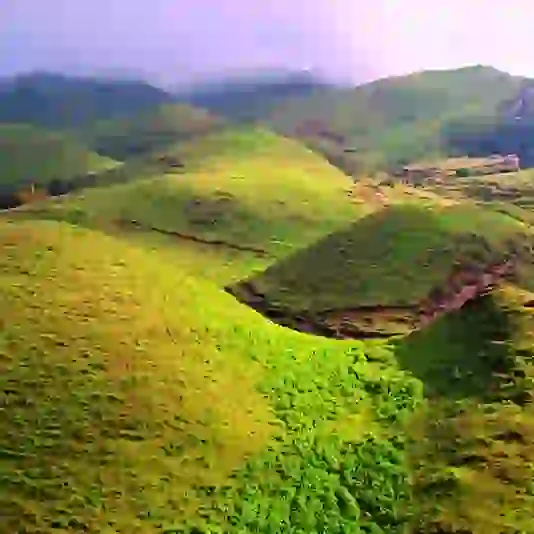
Geography of Dang District
The greater easterly and upstream sections of the parallel Inner Terai valleys of Dang and Deukhuri and encircling ranges of hills and mountains make up this region. Both valleys meet in Banke District downstream.
To the south, the district borders Uttar Pradesh, a state in India that borders Nepal—specifically, the Awadh districts of Balarampur and Shravasti. No Outer Terai is spreading onto the main Ganges Plain inside this district since the international boundary follows the southern edge of the outermost Siwalik foothills called the Dudhwa Range. Because the Siwaliks' porous geology prevents moisture retention or soil growth, they are covered with unproductive scrub forest.
The Dudhwas climb sharply to a peak at around 700 meters, then gradually descend into the Deukhuri Valley, reaching a low point of 250 meters near the Rapti River. The Rapti had to detour west around the Dudhwas before turning southeast along with the primary trend of the plains into India since the Dudhwas were more than 100 kilometres long.
Deukhuri has a near-tropical climate and is well-watered by the river, and has plenty of groundwater. The Dang Range rises as high as 1,000 meters north of Deukhuri Valley, passing about 700 meters. The Babai River, a tributary of the Ghaghara, drains the Dang Valley, located north of these hills (Karnali).
The Babai Valley has an elevation of 600 meters, with alluvial slopes gradually increasing northward to 700 meters at the Mahabharat Range's foot. The area then continues upslope to the Mahabharats' crest, which is 1,500 to 1,700 meters. Pyuthan, Rolpa, and Salyan are the districts to the north.
The Rapti River in western Nepal runs through the lower Dang valley for the most part. It runs beneath the Churia range on the northern side of the hills before exiting on the southern side. Sisahaniya of Rapti Rural Municipality and Mahadeva of Gadawa Rural Municipality in Dang district are connected by Nepal's second-longest bridge across the Rapti river.
Cultural Heritages in Dang District
Dang Valley has a diverse cultural legacy that includes a blend of Hinduism and an earlier Tharu civilization. Dang Deukhuri district has several temples and gumbas with puranic legends like Mahabharata, Shaivism, Shaktism, and Gorakhnath, making it one of its most culturally diverse areas.
The following are some of the most important heritage sites in the Dang Deukhuri District:
Ambikeshwari Temple
Ambikeshwari Temple is a spiritually significant Hindu temple in Dang's district. The temple, also known as ‘Maiko Than' (Mother's Place), lies 1.5 kilometres north of Ghorahi on the bank of the Katuwa Khola.
According to Hinduism's Swasthani Purana, the temple arose due to Satidevi's right ear falling off. This temple is Dang Valley's most renowned Shaktipeeth.
Dharapani Temple
Dharapani Temple is located in the district's Dharna municipality-01, at the base of the Chure range, south of the Babai River, about 9 kilometres from Ghorahi's centre. The temple is located where the five Pandavas brothers sat and sang Shiva prayers on their trek to Uttarapantha (Himalayas).
The temple has the world's largest Trishula and is one of the valley's most popular tourist attractions. The temple has been a popular destination for Hindu worshippers and notable Nepalese figures such as the President, police heads, chief judges, and ministers.
Ratnanath (Gorakhnath) Mandir, Chaughera
Chaughera's Ratnanath (Gorakhnath) Mandir is located in the Ghorahi sub-metropolitan city of Chaughera. It is a popular tourist and spiritual destination in the Dang District. Yogi Ratna Nath, Yogi Gorakhnath's third-in-line, is the temple's namesake.
Since ancient times, the temple has had a tremendous spiritual significance for the rulers of the valley; as a result, even after the shift of power to new dynasties, the temple's interior operations were almost totally undisturbed for hundreds of years.
The story of the monastery's founding is linked to the kings of the valley, as it speaks of a king who went jungle hunting and noticed a magnificent deer and fired an arrow at it. The injured deer bolted into the woods, and the king chased after it. Then, in the middle of the forest, he came face to face with a brilliant ascetic, sat in deep concentration with an arrow in front of him.
The king acknowledged his error and apologized. The Siddha pardoned him and bestowed upon him the capacity to rule over the Dang Valley through yogic strength. Ratannath, Yogi Gorakhnath's student, seized the arrow and presented it to the monarch, saying, "As long as you maintain the arrow, you will keep your kingdom firm."
The king then began to worship Ratannath, and the king's bloodline has continued to do so for the last six months, keeping the arrow. The Yogis worshipped the arrow for the other six months, and the monarch was forced to pay them half of his kingdom's earnings." Narharinath 2022: 516 (summarized from Narharinath 2022: 516).
Barhakune Daha (Baraha Chhetra)
Barhakune Daha (Baraha Chhetra), commonly known as Baraha Chhetra, is a sub-metropolitan city located 3 kilometres north of Ghorahi. During the Makar Sankranti holiday, the region is dedicated to the Hindu God Vishnu, who is extensively revered. The name originates from the twelve "bara" (Nepali) corners of a pond surrounding the temple.
Chameri Cave
Chameri cave, located on the Mahabharat range's slopes, is also known as the "Siddha" cave and is said to have been utilized by saints for penance in the valley. The cave has also piqued archaeological curiosity since prehistoric humans might have used it.
The cave is four stories tall and has a large ground hall that can hold about a thousand people. The cave of Chameri is of archaeological significance, and different preliminary observations and study are being carried out.
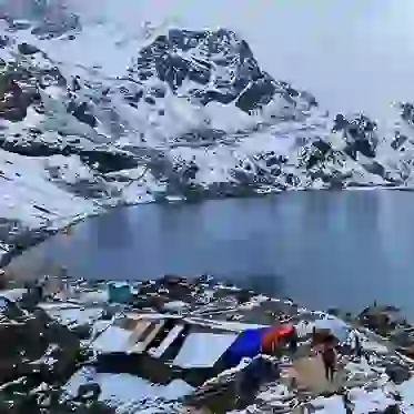
Jakhera Lake
Jakhera Lake, which means "rain-water collecting," is a lake in Dang's Lamai Municipality-5, about 35 kilometres from Ghorahi, with two Ganesh and Siddeswor Mahadev temples around it. The lake is a popular tourist destination in the area and a great place to picnic and sightseeing. The lake, which is 6 feet deep and spans 12 hectares, is located at the base of the Chure hills.
Transportation in Dang District
The East-West Route, Nepal's primary east-west highway, traverses the Deukhuri Valley, passing via Kalakate and Bhalubang Bazar on the upper end and Lamahi on the lower back. Branch roads from Bhalubang run up the Rapti River into the Pyuthan and Rolpa districts.
Highways are leading north through the Dang Range to Ghorahi and south through the Dudhwas to Koilabas, formerly a major international trading centre. The East-West highway, which runs through Lamahi, connects the Banke and Kohalpur districts. Rolpa district and the Swargadwari pilgrimage site are accessible by roads from Ghorahi.
A motorable road leads north from Tulsipur into Salyan District. Sisahaniya of Rapti Rural Municipality and Mahadeva of Gadawa Rural Municipality in Dang district are connected by Nepal's second-longest bridge over the Rapti river. Dang Airport in Tarigaun offers a daily scheduled flight to Kathmandu, Nepal.