Thorong La Pass is the dramatic high point of the Annapurna Circuit Trek and one of the most memorable places trekkers reach in Nepal. Standing at 5,416 metres above sea level, the pass connects the high valley of Manang with Muktinath and the dry landscapes of Mustang.
Reaching the top of Thorong La Pass involves more than simply following a mountain trail. Trekkers must gradually adjust to the altitude, prepare for freezing temperatures, and complete a long crossing day that may require 8 to 10 hours of walking.
The reward is an unforgettable Himalayan experience: colourful prayer flags, vast mountain slopes, sweeping valleys and the satisfaction of crossing from one distinct geographical region of Nepal into another.
Where Is Thorong La Pass Located?
Thorong La Pass is located in the central Himalayas of Nepal, north of the main Annapurna massif. It forms a natural route between the Marsyangdi Valley on the Manang side and the Kali Gandaki region on the Mustang side.
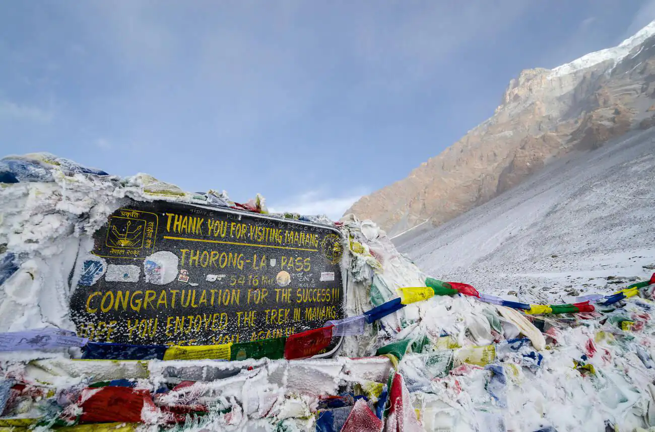
Most trekkers approach the pass from Manang, gradually gaining elevation through Yak Kharka, Ledar and Thorong Phedi. After reaching the summit, the trail descends towards Muktinath and Ranipauwa in Lower Mustang.
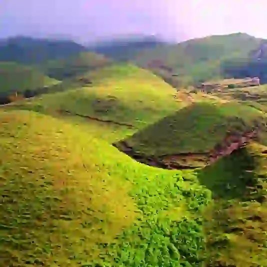
Crossing the pass is also a geographical transition. The greener valleys and mountain settlements of the eastern Annapurna region gradually give way to the dry, wind-shaped and Tibetan-influenced landscapes of Mustang.
How High Is Thorong La Pass?
The official altitude of Thorong La Pass is 5,416 metres (17,769 feet) above sea level. It is the highest point reached during the standard Annapurna Circuit Trek. At this elevation, the amount of available oxygen is significantly lower than at sea level. Walking becomes slower, breathing feels heavier and simple physical activities can require greater effort.
The altitude, rather than technical terrain, is the principal reason the crossing is challenging. Proper acclimatisation in Manang and a gradual approach towards Thorong Phedi are therefore more important than walking quickly.
Why Is Thorong La Pass Famous?
Thorong La is famous for combining physical achievement, Himalayan scenery, and a dramatic change in landscape.
Highest Point of the Annapurna Circuit
Thorong La is the highest point on the Annapurna Circuit, making it the symbolic and physical climax of the journey.
Transition Between Manang and Mustang
The route crosses from Manang’s high mountain valley into the drier trans-Himalayan environment of Mustang. Trekkers experience noticeable changes in vegetation, architecture, culture, and scenery.
Colourful Prayer Flags
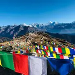
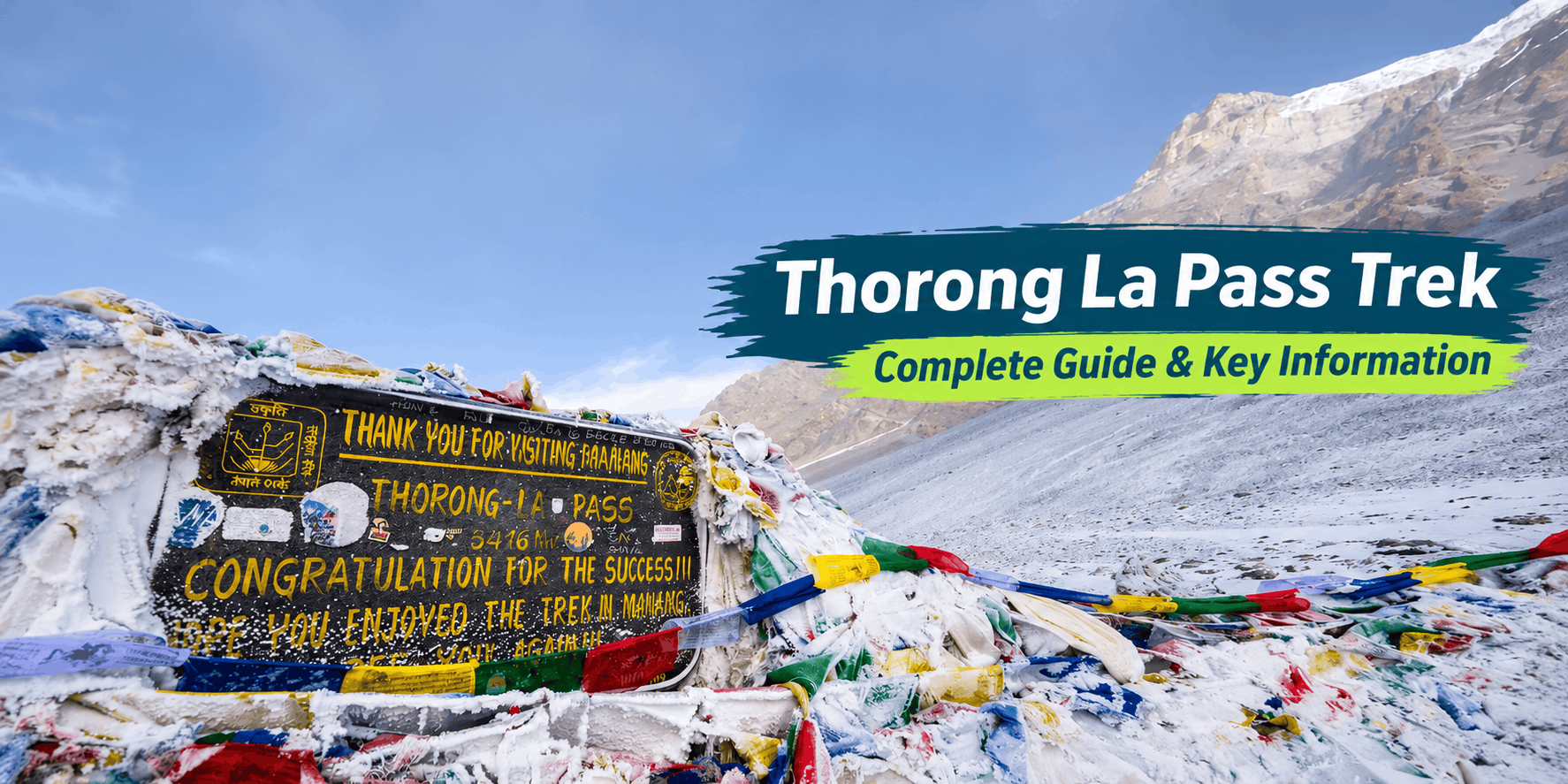
The Thorong La Pass sign and surrounding prayer flags have become one of the most recognisable images of the Annapurna Circuit. Many trekkers pause here briefly for photographs before beginning the long descent.
Journey to Muktinath
After crossing Thorong La, trekkers descend towards Muktinath, an important pilgrimage destination respected by both Hindus and Buddhists.
Typical Route to Thorong La Pass
The most common and generally recommended direction is from Manang towards Muktinath because it provides a more gradual approach to the pass. This direction allows trekkers to gain elevation more gradually before attempting the pass.
A typical section of the itinerary is shown below. Walking distances and times are approximate and may change according to the lodge used, trail conditions, fitness and weather.
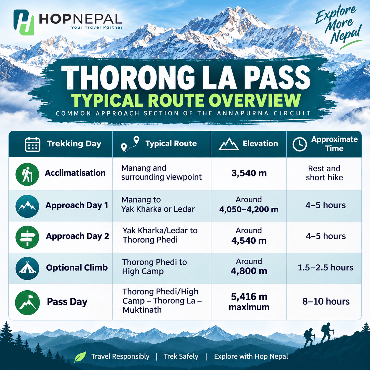
- Acclimatisation: Manang and surrounding viewpoint — 3,540 m — Rest and short hike
- Approach day 1: Manang to Yak Kharka or Ledar — Around 4,050-4,200 m — 4-5 hours
- Approach day 2: Yak Kharka/Ledar to Thorong Phedi — Around 4,540 m — 4-5 hours
- Optional climb: Thorong Phedi to High Camp — Around 4,800 m — 1.5-2.5 hours
- Pass day: Thorong Phedi/High Camp-Thorong La-Muktinath — 5,416 m maximum — 8-10 hours
Manang to Yak Kharka
The trail leaves Manang and climbs gradually through open alpine terrain. Vegetation becomes increasingly sparse as trekkers move towards Gunsang, Yak Kharka and Ledar. This day should be completed slowly. Although the walking distance is manageable, the increase in elevation while sleeping is significant.
Yak Kharka to Thorong Phedi
The trail continues through exposed mountain terrain towards Thorong Phedi. Sections may be rocky, and landslide-prone slopes require careful walking.
Thorong Phedi is normally the final major settlement before the pass. Some trekkers continue to High Camp, but sleeping higher is not necessarily better for everyone. The decision should depend on acclimatisation, weather and physical condition.
Thorong Phedi or High Camp to Muktinath
Pass day usually begins between approximately 4:00 and 5:00 AM. Trekkers climb gradually in the dark, using headlamps, before reaching the pass later in the morning.
After a short break at the pass, the route descends steeply towards Muktinath. The descent is long and can place considerable strain on the knees, especially when the trail is icy or covered with loose stones. The entire crossing typically takes about 8 to 10 hours, including 4 to 6 hours of ascent and 3 to 4 hours of descent.
How Difficult Is the Thorong La Pass Trek?
Thorong La Pass is considered challenging primarily because of the altitude, cold weather, and the length of the final day of trekking.
The trail does not normally involve technical climbing. Trekkers do not need previous mountaineering experience during favourable trail conditions. However, they should be comfortable walking for several consecutive days and completing long uphill and downhill sections.
High Altitude
At 5,416 metres, even slow walking can feel exhausting. Headache, nausea, dizziness, unusual fatigue and loss of appetite can be early signs of acute mountain sickness.
Long Pass Day
The crossing may require eight to ten hours of walking. Trekkers must climb to the pass and then complete a lengthy descent before reaching accommodation in Muktinath.
Freezing Temperatures
Early-morning temperatures can remain well below freezing, including during the main trekking seasons. Wind near the summit can make conditions feel significantly colder.
Snow and Ice
Fresh snow can hide the trail, while compacted snow and ice can make both the ascent and descent slippery.
Mental Fatigue
Poor sleep, reduced appetite, cold conditions and several days of trekking can affect motivation. A steady pace and realistic expectations are essential.
Acclimatisation for Thorong La Pass
Acclimatisation is one of the most important parts of a safe Annapurna Circuit itinerary. The Nepal Tourism Board advises trekkers above 2,500 metres to increase sleeping altitude gradually, generally by no more than around 300-500 metres per day, and to include a rest day after approximately every 1,000 metres of elevation gain.
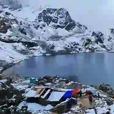
Most itineraries include at least one acclimatisation day in Manang. During this day, trekkers can complete a short hike to a higher viewpoint before returning to sleep at a lower elevation. Suitable acclimatisation walks around Manang may include nearby monasteries, viewpoints or the Gangapurna Lake area. The purpose is not to complete an exhausting excursion but to help the body adjust before moving towards Yak Kharka.
Best Time to Cross Thorong La Pass
The most favourable periods are generally spring (March to May) and autumn (September to November). These seasons normally provide more stable weather, functioning teahouses and better trail conditions.
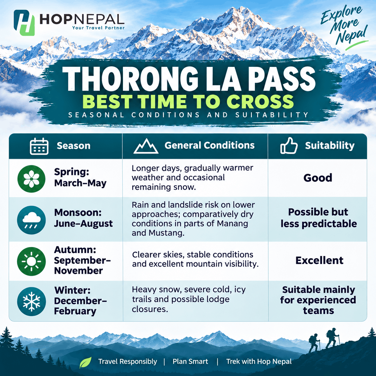
- Spring (March-May): Longer days, gradually warmer, with occasional lingering snow.
- Monsoon (June-August): Rain and landslide risk on lower approaches; comparatively dry conditions in parts of Manang and Mustang. Suitability: Possible but less predictable.
- Autumn (September-November): Clearer skies, stable conditions and excellent mountain visibility. Suitability: Excellent.
- Winter (December-February): Heavy snow, severe cold, icy trails and possible lodge closures. Suitability: Suitable mainly for experienced teams.
Spring
Spring usually brings gradually improving temperatures and longer daylight hours. Snow may remain around the pass, especially early in the season, but the trail is generally more manageable than in winter.
Autumn
Autumn is the most popular period for crossing Thorong La. Post-monsoon skies can provide clear mountain views, while temperatures are usually manageable with proper cold-weather clothing. October is often busy, so accommodation should be planned carefully.
Monsoon
Parts of Manang and Mustang lie within the Himalayan rain shadow, making them drier than Nepal’s southern slopes. However, the lower approach roads and trails can still experience rain, landslides, transport delays and cloud cover.
Winter
Winter crossings may involve deep snow, closed lodges, extreme wind chill and difficulty identifying the trail. The pass can become temporarily inaccessible after significant snowfall.
Accommodation Around Thorong La Pass
The Annapurna Circuit is primarily a teahouse trek. Lodges are available in Manang, Yak Kharka, Ledar, Thorong Phedi, High Camp and Muktinath. Most established Annapurna trekking routes are served by local teahouses, although facilities become simpler at higher elevations.
Rooms normally include basic beds and blankets, but heating is uncommon inside bedrooms. Dining rooms may have a stove during the evening.
At Thorong Phedi and High Camp, accommodation can fill quickly during peak season. Services may also close temporarily in winter or during severe weather.
Food and Drinking Water
Teahouses usually serve dal bhat, noodles, fried rice, soup, potatoes, pasta, eggs and simple breakfast dishes.
Food prices increase with elevation because supplies must be transported to remote settlements. Menus may also become more limited after Manang.
Boiled water, filtered water and packaged water may be available depending on the settlement. Carrying a reusable bottle and using a reliable purification method help reduce plastic waste.
Trekkers should continue eating even when altitude reduces their appetite. Warm soups, rice, potatoes and carbohydrate-rich meals can help maintain energy.
Permits Required for Thorong La Pass
Annapurna Conservation Area Permit
Thorong La lies within the Annapurna Conservation Area, so an ACAP entry permit is required.
Current official NTNC fees are:
- Foreign nationals: NPR 3,000
- SAARC nationals: NPR 1,000
- Children below 10: Free
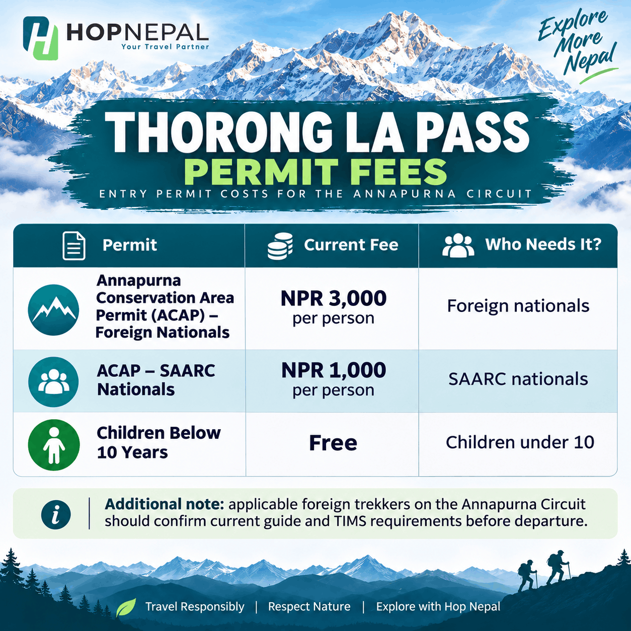
The NTNC currently provides an online permit system and permits payment at permit counters. Permit holders should register at checkpoints along the route.
TIMS Card and Guide Requirement
The Nepal Tourism Board lists the Annapurna Circuit among the trekking routes where foreign trekkers must, where applicable, be accompanied by a licensed guide and carry an agency-issued TIMS card.
The currently published TIMS charges are NPR 2,000 for most foreign nationals and NPR 1,000 for SAARC nationals. Regulations and enforcement can change, so travellers should confirm the latest requirements through a registered trekking agency before departure.
Final Verdict
Thorong La Pass is more than the highest point of the Annapurna Circuit. It is the moment when days of gradual climbing, acclimatisation and physical effort come together.
The route is demanding, but it is not reserved only for experienced mountaineers. Trekkers with appropriate fitness, a gradual itinerary, suitable equipment and respect for the altitude can complete the crossing safely.
Preparation remains essential. Spend enough time acclimatising in Manang, monitor the weather, begin the pass day early and never ignore symptoms of altitude sickness. Reaching the prayer flags at 5,416 metres is rewarding, but returning safely to lower elevation is the true measure of a successful trek.
With experienced local guides, properly arranged permits and a carefully designed itinerary, Hop Nepal can help travellers experience Thorong La Pass and the Annapurna Circuit with greater confidence, safety and understanding of the region.
FAQs
What is the altitude of Thorong La Pass?
Thorong La Pass stands at 5,416 metres or approximately 17,769 feet above sea level. It is the highest point of the Annapurna Circuit Trek.
Is Thorong La Pass difficult?
Yes. It is challenging because of the altitude, cold temperatures, steep terrain and long crossing day. However, it does not normally require technical climbing skills.
How long does it take to cross Thorong La Pass?
Most trekkers require approximately eight to ten hours to travel from Thorong Phedi or High Camp across the pass and down to Muktinath. Walking time varies depending on snow, fitness, and acclimatisation.
Is Thorong La Pass open throughout the year?
The route does not have a fixed annual opening date, but heavy snow can temporarily close or obstruct it during winter and after storms.
Can beginners cross Thorong La?
Fit beginners can complete the crossing with proper training, acclimatisation, suitable equipment and a well-planned itinerary. It is not recommended as an unprepared first mountain hike.
Do I need technical climbing equipment?
Ropes and mountaineering equipment are not normally needed. Microspikes may be useful when the trail is icy, depending on current conditions.
Is a guide mandatory for Thorong La Pass?
Current Nepal Tourism Board guidance lists the Annapurna Circuit among routes requiring applicable foreign trekkers to travel with a licensed guide and carry an agency-issued TIMS card.
Where do trekkers sleep before crossing the pass?
Most trekkers stay at Thorong Phedi or High Camp. The better choice depends on the trekker’s acclimatisation, health and weather conditions.
Do I need travel insurance?
Yes. Insurance should specifically cover trekking to at least 5,500 metres as well as emergency helicopter evacuation, medical treatment and trip disruption.