The Rautahat District, located in Province No. 2, is one of Nepal's seventy-seven districts. Gaur, which includes municipalities such as Garuda, Chandrapur, and Paroha, has a population of 545,132 in 2001 and 686,722 in 2011. It occupies an area of 1,126 km2 and has a population of 545,132 in 2001 and 686,722 in 2011.
There are two VDCs and 16 municipalities in this district. Rautahat, among other districts, has the highest percentage of Muslims in Nepal, at 19.465 overall (106,111 persons in 2001). The most Muslim-densely populated village in Nepal, Bairiya (in the Rautahat district), serves as an example of Nepal's secularism. The only sugar mill in Garuda municipality is Sri Ram Sugar Mill.

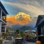
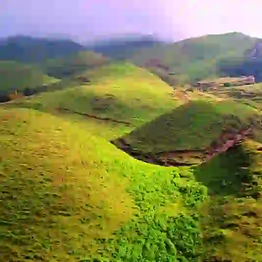
Rautahat: Heritage and Community Harmony
Credit:kathmandupost.com
The famous Shiva temple in Shivnagar, which the Giri family owns. Matsarri is home to Goddess Durga's historical temple. This Village was home to the late Shri Gulab Narayan Jha, the first person to represent Madhesis in politics. In Chandrapur, Rautahat, there is a spot called Najarpur, where the whole village is vegetarian. They are not yet permitted to purchase or sell alcoholic drinks, nor are they allowed to buy or sell tobacco products.
Nunthar is a famous picnic spot, and there is a Shiva temple in Paurai Bagmati, Rautahat.
Natural resources abound in Nepal's Rautahat district. The Rautahat forest is home to a diverse range of trees and medicinal plants. In Rautahat's forest, there is a thick forest with a variety of wild animals. Cheetahs, tigers, elephants, and various snakes are among the animals.
The Rautahat forest is also home to a variety of species. Doves, hornbills, parrots, pigeons, cuckoos, and other birds are among them.
Climate of Rautahat District
The district of Rauthhat is divided into two climatic zones. They are:
- Lower Tropical
- Upper Tropical
Gaur in Rautahat District
Gaur is the administrative centre of the Rautahat district in Nepal's Narayani zone. It has a customs checkpoint and is located on the Nepalese border, which connects India through Bairgania.
Transportation in Gaur
The Gaur-Chandranigahpur Highway, also known as the Birendra Highway, begins there and connects to the East-West Highway in Chandrapur, connecting Gaur to all of Nepal's major cities.
The transportation service is dependable. There are more than 15 buses that run directly to Nepal's capital, Kathmandu, including five Volvo buses. Other major cities such as Birgunj, Janakpurdham, Pokhara, Biratnagar, Nepalgunj, Bharatpur, and others can be reached by bus.Simara Airport, the nearest domestic airport, is in Simra, while Nijgadh International Airport, the nearest international airport, is under construction in Nijgadh.
For international flights, passengers currently use Tribhuvan International Airport in Kathmandu, Nepal's capital. The closest domestic airport in India is Patna's Jai Prakash Narayan Airport, which is about 177 kilometres from Gaur.
Since it is a Nepalese border that connects India via Bairgania, one can use Indian Railways to travel to all of India's major cities. Gaur is about 3 km from Bairgania railway station, which has a variety of local transportation options such as tangas, rickshaws, and so on.
Rautahat shares its border with India
Gaur, Rautahat is significant because it shares a border with Bairgania, India. To cross the border, no documents are needed. Many edible and electronic items are subject to limits, and they are thoroughly inspected before being allowed to pass.
Gaur's customs office keeps track of vehicles entering the country with Indian registration numbers. On heavy products/items entering Nepal, the office imposes those taxes.
Places to visit in Rautahat
Nunthar
Nunthar, located on the boundary of Rautahat, Makwanpur, and Sarlahi in the midst of the Chure forests, is home to religious pilgrims who visit the Shiva Temple. Legend and lore are incorporated into the tale of the shrine, which is said to be over 100 years old.

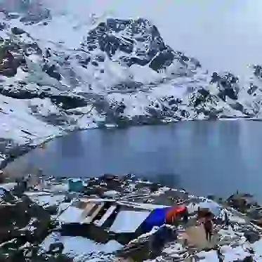
Rautahat: Vibrant Cultural Heartland
Credit:common.wikimedia.org
A deep well of acidic water is located on the temple's southern slope. Locals assume that the water in the well has curing powers, and they come to the temple on a daily basis to sample the water.
Domestic tourists flock to Nunthar from the nearby districts of Sarlahi, Dhanusha, Mahottari, Bara, Parsa, and Makwanpur. Taking advantage of the growing foot traffic, the local government has taken steps to turn the city into a major tourism destination.
Junge Jharana
Junge Jharana is another place to see in Rautahat. It's about 16 kilometres west of Nunthar, and it's one of the district's less-visited spots.
The jharna is located in the Hattidamadar Forest Area, about a 20-minute walk from the banks of the Marpha River. Since waterfalls are uncommon in the Tarai plains, this jharana is familiar to locals but not yet with visitors. On his visits to the city, Junga Bahadur Rana, the first Rana Prime Minister, is said to have spent time by the jharana.
Junge Forest
The Junge forest surrounds the Junge jharana. The forest's rich flora provides an excellent habitat for a range of birds and wildlife, including peacocks, ghorals, chittals, deer, wild boar, porcupine, and bears. In the spring, flowers like Parijat bloom in all their glory in the trees.
Musahar
The Musahar Settlement in Chandranigahapur is the next stop, and it made headlines because the famous Dhurmus Suntali pair founded it. Visitors from all across the country came to Rautahat to view the model settlement established by the Dhurmus Suntali Foundation.
A view tower has been constructed within the village that provides a 360-degree view of the nearby hills. To ascend the clock, visitors must pay a fee of Rs 100.
Locals estimate that 200 people visit the settlement every day. The settlement is reached by driving south of Chandranigahapur along a 7-kilometre-long incline path.
BP Park
The BP park is another well-known attraction in Chandranigahapur. Picnickers flock to the park because it has a beautiful view of the surrounding trees as well as plenty of room to relax.
Mardhar Wetland
The Mardhar Wetland, about 4 kilometres south of the East-West Highway, is the nearest wetlands to the district headquarters. The wetland's vast expanse attracts Siberian birds migrating from the frozen mountains to the southern plains' warmer atmosphere. It is often used in educational tours for students due to its high biodiversity.
Najarpur
The Najarpur village is another exciting destination in the district. The town is best known for Nijananda Dham, which also houses a Lord Krishna temple. The village's embrace of vegetarianism is the second explanation for its popularity. Any person in the village is a vegetarian.
The Najarpur village, founded 55 years ago and located 7 kilometres south of the East-West Highway, has been added to Province 2's list of religious tourism destinations.
Maulapur Madhani
In another location, archaeologists discovered the remains of a 1,000-year-old temple in Maulapur Madhani in September of last year.
Rautahat District in Nepal comprises 18 municipalities, including 16 urban and 2 rural municipalities
- Baudhimai Municipality
- Brindaban Municipality
- Chandrapur Municipality
- Dewahi Gonahi Municipality
- Gadhimai Municipality
- Garuda Municipality
- Gaur Municipality
- Gujara Municipality
- Ishanath Municipality
- Katahariya Municipality
- Madhav Narayan Municipality
- Maulapur Municipality
- Paroha Municipality
- Phatuwa Bijayapur Municipality
- Rajdevi Municipality
- Rajpur Municipality
- Durga Bhagwati Rural Municipality
- Yamunamai Rural Municipality